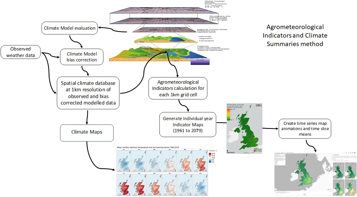
Agrometeorological Indicators in the UK
This is a multidimensional mosaic dataset showing multiple agrometeorological indicators in the United Kingdom from observed data (1961-2020) and 12 projections and mean projections (2021-2080).
Are you interested in exploring what climate change means for you and where you live or the whole country?
Use this site to see yearly time step animations of key Agrometeorological Indicators and Climate Summaries
from 1961 to 2080 that illustrate how the climate has changed and is likely to change over the coming decades.
The purpose is to help you visualise and explore in space and time what climate change might mean for the UK
in terms of climate determined features that affect people, nature, agriculture and land use.
The rationale is to help you consider how you might adapt your lives, property and business
to cope with climate change and build resilience.
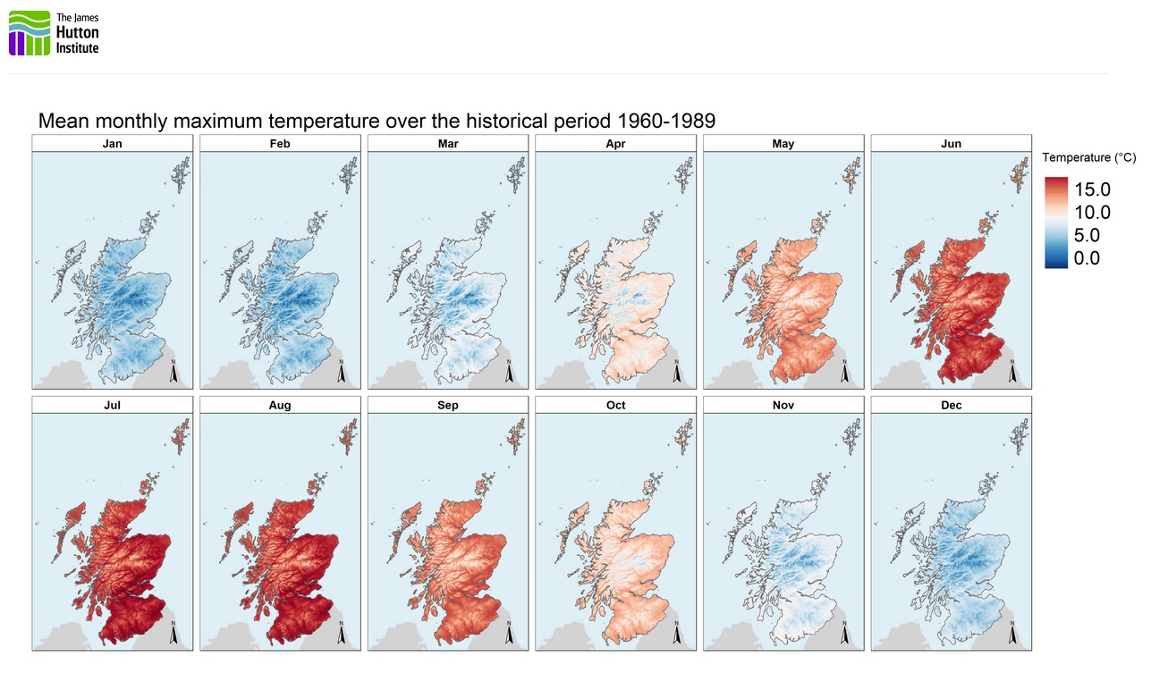
Here, you can explore a wide range of climate maps and data, including:
This is a multidimensional mosaic dataset showing multiple agrometeorological indicators in the United Kingdom from observed data (1961-2020) and 12 projections and mean projections (2021-2080).
This work was supported by the Rural and Environment Science and Analytical Services Division for the JHI-D5-2 ‘Climate Change Impacts on Natural Capital’ Project funded by the Scottish Government Strategic Research Programme 2022-2027. Data provided by the UK Meteorological Office and UKCP18 Climate Projections.
We would love to hear from you! If you have any questions, feedback, or would like to collaborate, please don't hesitate to reach out to us. Our team is here to assist you and provide further information on the climate data and agrometeorological maps provided by The James Hutton Institute.